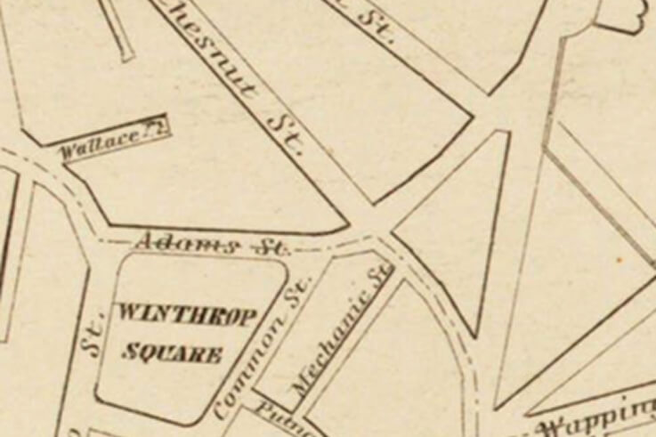
Chestnut Street
Lower Chestnut Street, between Adams Street and Lowney Way, existed as a street as early as 1818 (see Tufts map), when it was called Shippey Street. It has a development history that is separate from that of upper Chestnut Street. During the 1830s and early 1840s it was called Townsend Street in honor of Samuel Townsend, whose wooden house stood at the corner of Adams and (then) Townsend Streets. Until the late 1840s, the Townsend house was the only house in lower Chestnut Street. It was surrounded by horse chestnut trees, hence, the present name Chestnut Street.
Upper Chestnut Street had been part of the Nathan Adams (later George Adams Kettel) estate. It started out as a lane leading northward, up Breed’s Hill to the George Adams Kettel house, which was once opposite 50 Chestnut Street. Kettel subdivided his estate into house lots as early as 1840 and early house construction within the Adams/Kettel tract dates to the early 1840s. The Adams/Kettel mansion house was located at the site of the now vacant Bunker Hill Post #26, opposite 50 Chestnut Street. The nucleus of Chestnut Street was the lane which led from Adams Street to the Adams-Kettel mansion house. The first houses in the Adams/Kettel development were built on the upper slopes of Breed’s Hill, presumably to make the most of spectacular views of Boston and Boston Harbor.
Twenty-nine houses were included in the survey, built between the 1840s and 1878.
- Eighteen were built as Greek Revival houses, between circa 1839 and the early 1860s. Six of these were subsequently altered in the Italianate style.
- There are eight Italianate style houses, built between 1853 and 1858.
- There is one Mansard style house, built circa 1868-74, and one Italianate/Mansard house, built in 1872-3.
- The latest house in the survey, built in 1878, is difficult to categorize stylistically, having elements of Eastlake, Italianate, and Queen Anne styles.
*Information drawn from Boston Landmark Commission’s Charlestown Historic Resources Study 1981 (E. W. Gordon, Consultant), with the addition of photographs and images from early maps and/or the Mallory Panoramic View of Charlestown, when appropriate.
 Peter Tufts 1818. Note Shippey Street, and Adams and Breed lands.